
More viable projects in the pipeline, faster
Don’t let unexpected risks or costs derail your projects. De-risk development and identify the path to power earlier with intelligent data and expert-backed services.

De-risk earlier
Catch grid, environmental, and permitting risks before investing time and resources.

Accelerate development
Shorten timelines by automating diligence. Move from origination to construction-ready in half the time.

Scale confidently
Do more with fewer resources through automation and expert support.
Traditional development is broken

.svg)
.svg)
Built for every player of power development
Paces accelerates how power gets built by helping developers and utilities move faster, together.


AI, Software and Services for speed and scale
An AI Agent that orchestrates a unified stack of software, modular reports, and expert validated services to accelerate site viability, identify grid constraints, and unlock new scale in power development.
AI Agent and Software for faster development
Accelerate your project pipeline and halve the time to shovel-ready, with AI and software backed by world-class data and human expert validation.


Expert-grade Services and Reports, built for speed
Combining human expertise and AI to help energy move faster from concept to power.


Sign up for emails
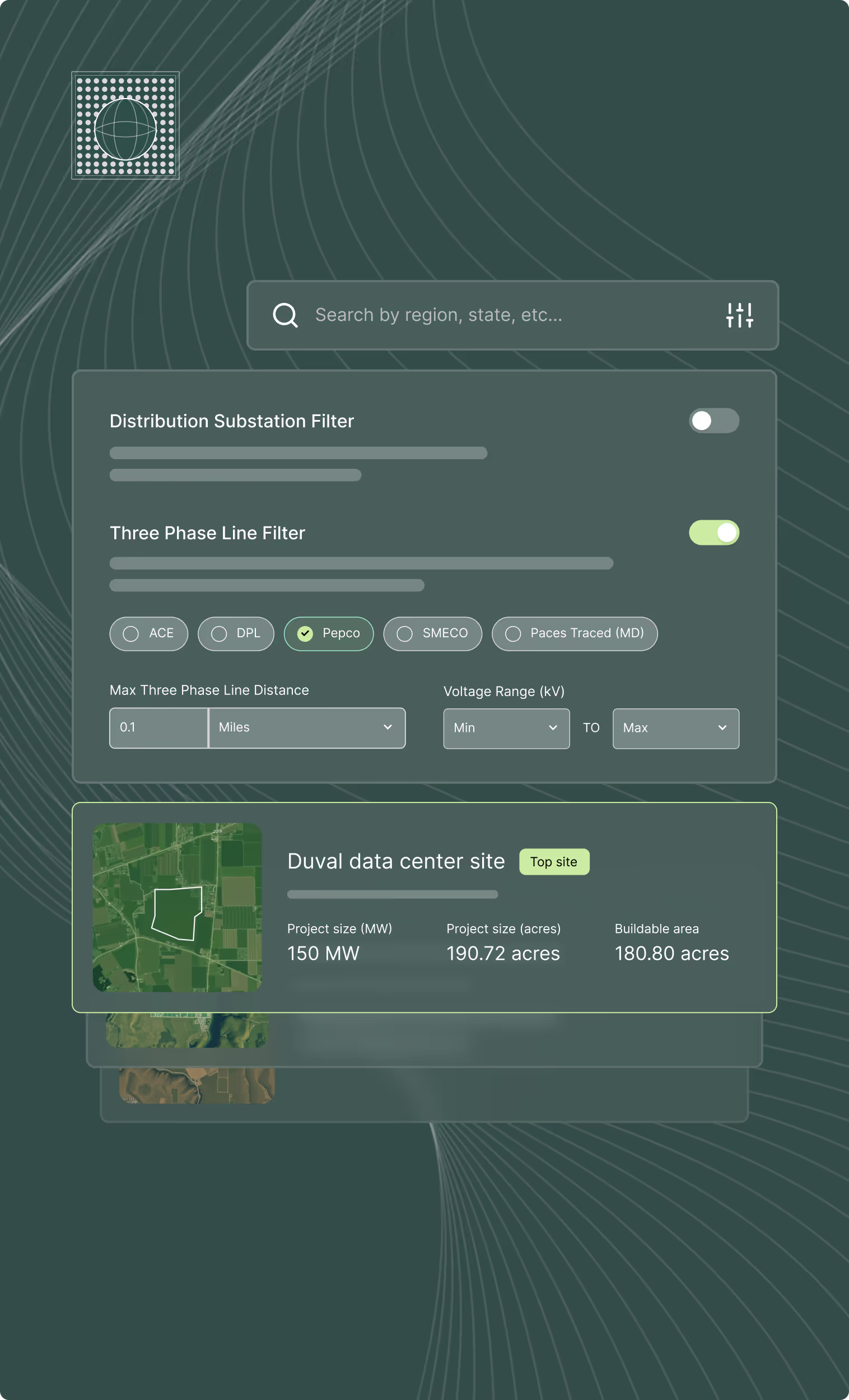
Find the right sites faster, assess feasibility with world class data, and track progress across your entire project pipeline with software built to compress your workflow.
